A living history of WX Rundown — radar tools, alerts, Streamer Mode, and the features built for weather enthusiasts, creators, and live coverage.
NEWLatest
The map opens faster with no loading screen, lightning now lines up with each radar scan, navigation shows the posted speed limit, and satellite views get a clear outline.
Faster map, no loading screen
The old splash page is gone. The map now appears right away while alerts, radar and everything else fill in behind it. We also trimmed the amount of code the map has to download up front, so it feels quicker to open, especially on phones.
Radar frames load faster, with a progress bar
Radar scans now download once instead of several times, so selecting a site loads sooner. The blue frame loading bar is a little thicker and shows the percent complete with a frame count (like 7/10) in the middle.
Lightning that follows the radar
Pro
When you play the radar loop, lightning strikes now appear and disappear as they actually happened. Each radar scan shows the strikes from its own time window, with a little overlap between scans so nothing that struck in the gap gets missed.
Layers → Lightning
Speed limit in navigation
While you navigate, the posted speed limit shows next to your speed on a familiar white sign. Your speed turns red when you are over the limit. Tap the gauge button on the navigation card to turn it off. Limits come from map data and can vary, and the sign hides when the limit is not known.
Navigation fits better on phones
When you start a navigation on your phone, the radar tools tray tucks itself down so you can see the map, and the navigation card sits just above the minimized tray instead of overlapping it. The tray returns to how you had it when the trip ends.
Search an address, land at street level
Search for a home or business address and the map now zooms in to street level instead of stopping at a wide view.
Clear outlines on satellite views
Satellite products now show an outline of the coastline and country borders on top of the imagery, so it is easy to see where you are on any product.
Quicker alerts and tighter security
Weather alerts now load from a much smaller file, so they arrive sooner on slower connections. Behind the scenes we also locked down account protection and email unsubscribe links.
NEW
Globe view now sits in the real night sky — true star positions, constellation figures, and the Milky Way, with the sun and moon placed by live ephemeris.
A real sky behind the globe
Pro
The space around the globe is now the actual sky instead of a scatter of random dots. Every star to magnitude 6 is drawn at its catalogued position and colour, the constellation figures are traced between them, and the Milky Way runs along the galactic plane with its bright clouds in Sagittarius, Cygnus, and Carina sitting where they belong. Spin the globe from Texas to Tokyo and the sky turns with the Earth.
Settings → Map → Map Style → Globe View
Sun and moon where they really are
Pro
The sun and moon are positioned from live ephemeris for the current date and time, so they sit exactly where they would be over the part of Earth you're looking at. Swing round to the night side and the sun blazes past the limb; the moon shows tonight's true phase with its lit edge turned toward the sun.
NEW
Environment Canada alerts are live on the map, and Pro users can switch the live map to a 3D globe with atmosphere instead of a flat Mercator view.
Globe view
Pro
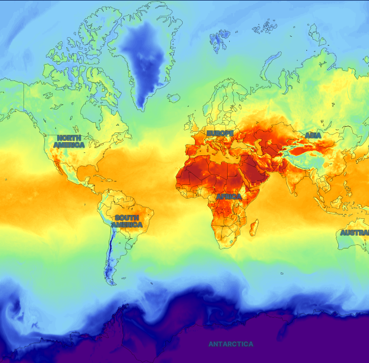
Switch the live map from a flat Mercator projection to a 3D globe with atmosphere and stars. Satellite imagery drapes onto the sphere so full-disk loops follow the curvature instead of sitting as a flat slab. Full Globe blends live Himawari + GOES-West + GOES-East GeoColor over a NASA GIBS VIIRS true-color base so Asia, Africa, and Europe stay filled. Radar, models, and other custom overlays appear as you zoom into a regional view, where the globe flattens automatically.
Settings → Map → Map Style → Globe View
Environment Canada weather alerts
Live ECCC alert polygons from MSC GeoMet now render on the map with the same 20-second refresh as NWS alerts. Tornado, severe thunderstorm, rainfall, snowfall, freezing rain, wind, heat, extreme cold, and special weather statements all get map colours, side-panel cards, and full-text detail modals attributed to Environment Canada.
Toggle warnings, watches, advisories and statements independently, switch alert text between English and French, and set a dedicated fill opacity and border thickness for Canadian regions. Every ECCC product also appears in Alert types & colors so you can restyle or hide any one of them.
The docked alerts panel gains a Canada tab with live counts, and each Canadian card carries an ECCC badge with its province so cross-border severe weather days stay easy to read on stream.
Alerts list → Canada
NEW
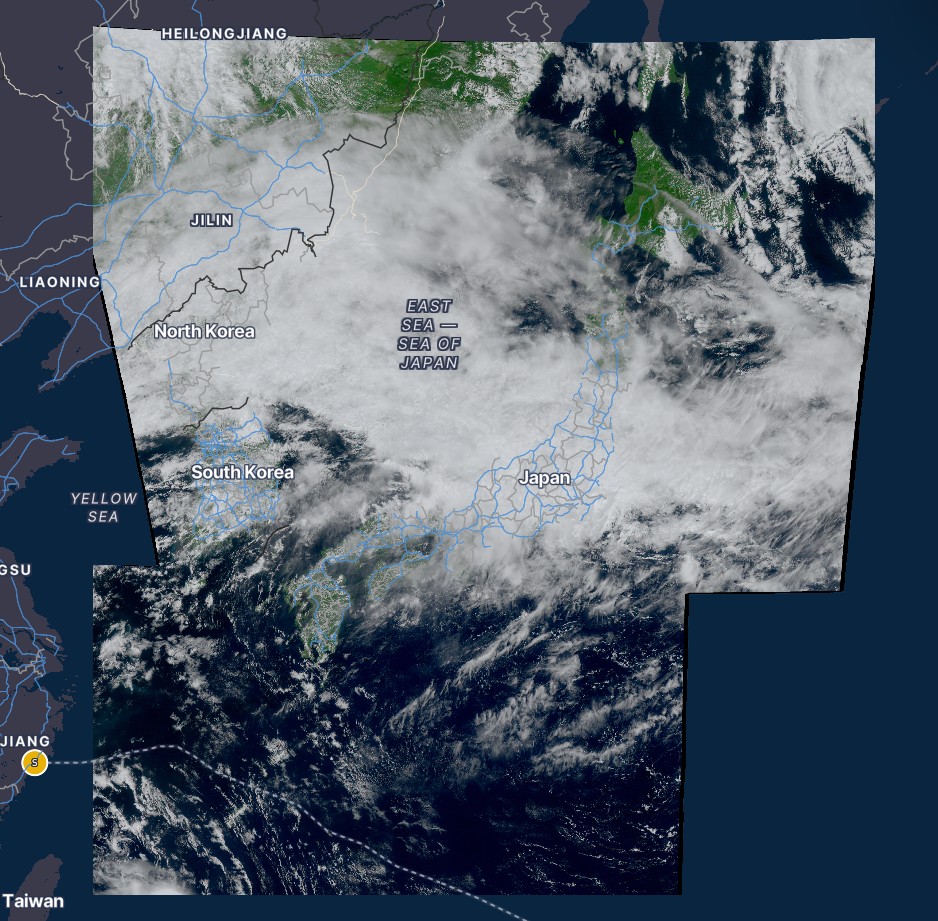
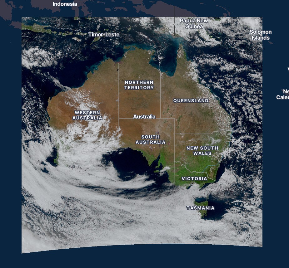
Himawari-9 GeoColor is live — Full Disk plus high-resolution Japan, Target, Australia, Philippines, and East Asia sectors.
Himawari-9 GeoColor
Pro
Asia–Pacific now has its own GeoColor bird. Pick Himawari-9 for a 10-minute Full Disk loop, native Japan, a moving Target box, and high-resolution Australia, Philippines, and East Asia crops — same Mapbox overlay as GOES, JMA / NOAA attribution.
Product dropdown → Satellite → Himawari-9 → GeoColor → Full Disk, Japan, Target, Australia, Philippines, or East Asia
NEW
Observations adds pollen, NWS HeatRisk, UV Index, HF radar currents, chlorophyll, and sea ice — official summer and marine desk layers with stream-ready legends.
Pollen outlook on the map
The same Day 1–7 pollen polygons from Forecast Maps now live under Observations → Pollen Outlook, with the familiar severe-to-low legend for on-air explainers.
Source → Observations → Pollen Outlook
NWS HeatRisk & UV Index
Experimental NWS HeatRisk (0–4) and EPA-style UV Index sit next to AQI and smoke for summer health desk. Official greens through magenta / violet keep the messaging clean on stream.
Source → Observations → NWS HeatRisk or UV Index
Chlorophyll, HF radar & sea ice
Pair SST with VIIRS chlorophyll (NASA GIBS), IOOS coastal HF radar current arrows, and sea-ice concentration plus Great Lakes NIC charts when published.
Observations now covers the missing half of flood and fire coverage — river gauges and smoke plumes — and buoys plus AQI live there too.
River gauges & flood stage
Switch Observations to River Gauges for NWS National Water Prediction Service / USGS stage dots. Colors follow official action, minor, moderate, and major flood categories so you can see which creeks are actually rising next to a flash-flood polygon.
Source → Observations → River Gauges
Smoke plumes
NOAA Hazard Mapping System smoke outlines sit next to wildfires and AQI. Light, medium, and heavy density polygons answer where the smoke is going — not just where the fire is detected.
Source → Observations → Smoke Plumes
Buoys & BuoyCAM
NDBC and partner marine stations worldwide now live under Observations → Buoys. Tap a station for wind, waves, air and water temps, then open the BuoyCAM panorama fullscreen when a daylight photo is available.
Source → Observations → Buoys
Air Quality (AQI)
AirNow monitoring-site AQI moved into Observations with the same pollutant filter. Pair it with smoke plumes when streamers ask what the air is doing downwind of a fire.
Source → Observations → Air Quality (AQI)
NEW
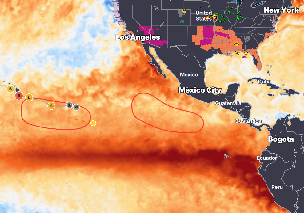
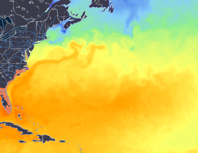
Observations is live — sea surface temperature, SST anomaly, ocean heat content, and station plots in one source.
Sea Surface Temps, Anomaly & Ocean Heat Content
A new Observations source puts ocean analysis on the map. Scrub through daily Sea Surface Temperature and SST Anomaly to watch the Gulf Stream, warm pools, and cool tongues evolve — then switch to Ocean Heat Content (kJ/cm²) over the North Atlantic for tropical fuel, or HRRR analysis and METAR/ASOS plots without leaving the source.
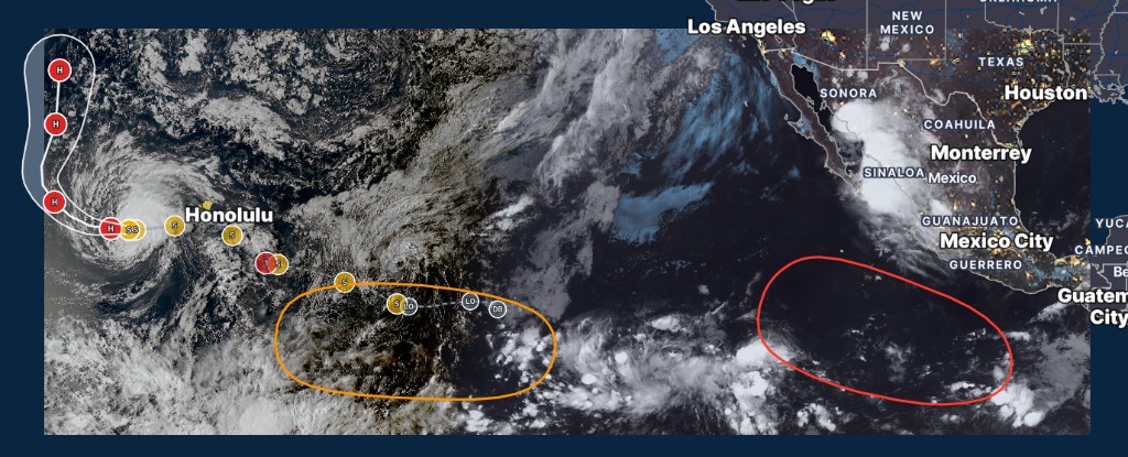
New GeoColor sectors for Alaska, Hawaii, and a sharper Puerto Rico view.
Alaska, Hawaii & Puerto Rico GeoColor
Pro
GOES-West now includes sharp Alaska and Hawaii GeoColor loops (Alaska spans the dateline from the Aleutians to the panhandle), and GOES-East Puerto Rico uses a sharper island-scale crop. Hawaii and Puerto Rico stay on GeoColor only — switching products returns you to CONUS or PACUS.
Product dropdown → Satellite → GOES-West Alaska / Hawaii, or GOES-East Puerto Rico
NEW
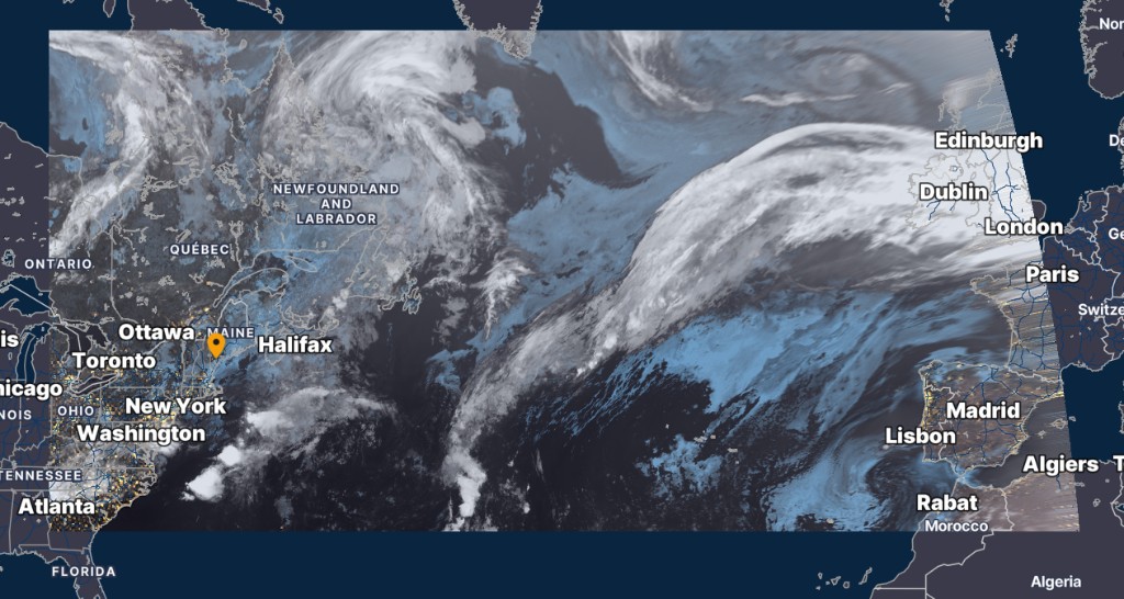
New GOES satellite regions: GOES-West Pacific Main Development Region and GOES-East North Atlantic.
New Satellite Regions
Pro
Two new GeoColor sectors make it easier to watch tropical development from space. GOES-West Pacific Main Development Region frames the East Pacific genesis box, and GOES-East North Atlantic covers the shipping lanes and mid-latitude systems from North America to Europe.
Product dropdown → Satellite → GOES-West / GOES-East → Main Development Region or North Atlantic
NEW
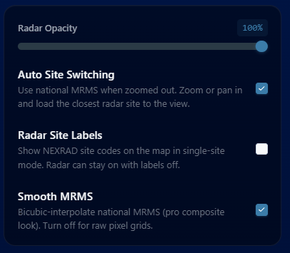
Auto Site Switching keeps national MRMS when you are zoomed out and loads the closest radar as you zoom or pan in.
Auto Site Switching
When you are zoomed out to a national or broad regional view, the map stays on national MRMS. Zoom or pan into an area and the closest NEXRAD site in view loads automatically, then updates as you move around the map. It is on by default and can be turned off anytime.
Map Tools → Radar → Auto Site Switching
NEW
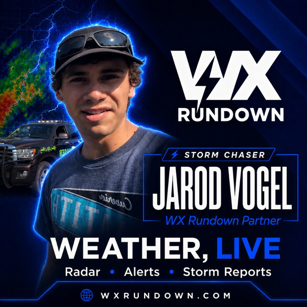
We’re excited to welcome Jarod Vogel as a new WX Rundown storm chaser partner!
Storm Chaser Jarod Vogel
We’re excited to welcome Jarod Vogel as a new WX Rundown storm chaser partner!
Based out of Duluth, Minnesota, Jarod provides both severe weather and winter weather coverage. He’ll also be working closely with us full-time this winter to help deliver excellent ground coverage.
We’re glad to have him on board and look forward to what’s ahead with Jarod as part of the WX Rundown team.
Map Layers → Storm Chasers
PRO
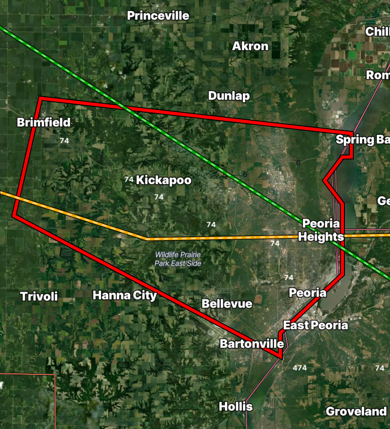
See the terrain beneath active weather at a glance with Satellite Peak.
Satellite Peak
Pro
Toggle Satellite Peak in Map Tools or press Shift+P to reveal the satellite basemap beneath a warning. Quickly see the surrounding terrain and answer questions like, “Is this tornado warning in a populated area?” It has never been easier to tell at a glance.
Available today for WX Rundown Pro users · Map Tools → Satellite Peak · Shift+P
NEW
Go global with the GFS model.
GFS Model
The Global Forecast System is live alongside HRRR. Scrub temperature, dewpoint, humidity, wind, gusts, visibility, MSLP, precip, reflectivity, CAPE/CIN, and helicity across the planet — with forecast hours out to F384 for the big-picture outlook.
Product dropdown → Models → GFS
NEW
A major week for radar, alerts, My Weather, Weather Events, and Streamer Mode — plus new Pro tools for rotation, outlooks, and storm arrival.
Rotation Detection Algorithm (RDA)
Pro
Spot tight rotation faster with the Rotation Detection Algorithm. RDA highlights couplets and storm structure, tracks rotation scan-to-scan, and loads the first frame immediately so you can scrub and animate without waiting on a full decode.
Pro → Radar products → Rotation Detection Algorithm (RDA)
Storm Arrival
One click from NWS storm motion draws the projected path with town names and ETAs along the leading edge — on desktop and mobile — so you can see which communities are next and when.
NWS alert → Storm Arrival
NWS Alerts Side Panel
A docked alerts column with severity sorting, “new” tags, and category tabs. Mesoscale and Tropical tabs pull real MCD and NHC data, and Map Tools / Settings can sit right beside the panel.
Open the NWS alerts side panel on the map
Push Alerts for Saved Locations
Pro
Background NWS push notifications for Pro and Creator accounts. Choose storm, marine, and zone types per location — tap a notification to jump straight to the alert on the map.
Account Settings → Push Alerts
Weather Events Fullscreen
Replay notable storms in a branded fullscreen player with a compact product dock and load progress. Recent tornado packs run longer (20 scans), including Enid, Appleton, Kentwood, and more.
Menu → Weather Events → Fullscreen
My Weather Refresh
A cleaner My Weather experience: upgraded hourly forecast, air quality and tide details, local storm reports, SPC/WPC outlook membership for each saved place, and sharp Meteocons icons.
Open My Weather / My Dashboard
SPC Day 4–8 Outlooks
Pro
Extended-range probabilistic outlooks with official 15% / 30% colors, plus a forecast discussion button so you can read the SPC reasoning without leaving the map.
Pro → Outlooks → Day 4–8
Hurricane Hunters
Follow live recon missions on the map with hurricane hunter positions and polished wind barbs as aircraft sample the storm.
Map Layers → Hurricane Hunters
Screen Export
Capture radar and outlook views for streams, briefs, and social — exports download automatically when you save a frame.
Radar / Outlook tools → Screen Export
Reflectivity Persistence
Hold recent reflectivity on the map as new scans arrive so storm cores and trails stay visible while you animate or scrub.
Radar settings → Reflectivity Persistence
Radar Inspector
Sample single-site radar under a center reticle to read values at the point you’re inspecting — built for quick structure checks during live coverage.
Single-site radar → Radar Inspector
HRRR Surface & Conditions
WeatherFront-style HRRR wind barbs and MSLP overlays synced to playback, with denser barbs as you zoom in and clearer high/low centers.
Product dropdown → HRRR → Surface / Conditions
Streamer Mode Upgrades
Emergency Tornado and Flash Flood safety screens, legend and modal placement with persistence, compact alert cards, auto-focus for MCDs and storm reports, and a live PowerPoint-style Presentation deck.
Streamer Mode → Overlays / Settings
Smoother Map Performance
Leaner pan/zoom, WebGL lightning, spotters, and high-volume markers, plus automatic map quality tiers so older devices stay usable on busy storm nights.
Works automatically — optional quality settings in Map Settings
Map Rotation & Tilt Lock
Lock rotation and tilt so accidental gestures don’t knock your broadcast or chase map off angle mid-event.
Map Settings → Rotation / Tilt lock
How To Guides & Shortcuts
Step-by-step guides for radar, streamer tools, and map workflows — plus a live keyboard shortcuts reference and Pro streamer hotkey rebinding.
Menu → How To
Branded Map Splash
A clean WX Rundown splash while the radar map initializes, so first load feels on-brand instead of a blank canvas.
Shown automatically when the map starts loading
PRO
See storms in three dimensions with volume radar and a live vertical cross-section.
3D Volume Radar
Pro
See the storm in three dimensions. Flip on 3D Volume Radar for any single-site NEXRAD scan, then dial tilts, reflectivity threshold, and opacity to carve through cores and structure like never before.
Select a radar site → 3D Volume Radar button
Radar Cross-Section (RHI)
Pro
Slice straight through the storm. Drop Point A and Point B on the map for a live vertical cross-section that updates as you move the slice — perfect for spotting elevated cores, overhang, and storm depth.
Select a radar site → Cross-Section / RHI button
PRO
Try WX Rundown Pro Monthly free for 7 days.
WX Rundown Pro — 7-Day Free Trial
Pro
Try WX Rundown Pro Monthly free for 7 days. Unlock advanced radar, Streamer Mode, exclusive map layers, forecast tools, and more — cancel anytime before the trial ends and you won’t be charged.
Streamer overlays, faster radar, custom alert colors, and smoother MRMS.
Streamer Mode Overlays
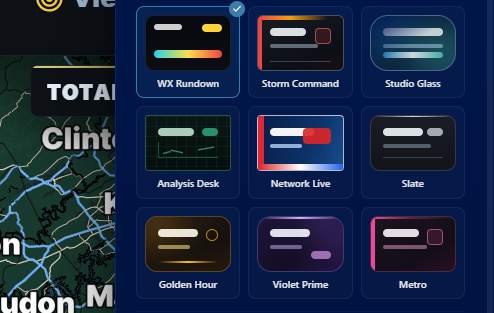
Suit up your broadcast. Pick from a full set of streamer overlays — WX Rundown, Storm Command, Studio Glass, Network Live, and more — so your stream looks as sharp as the weather you're covering.
Open Streamer Mode → choose an overlay
Lightning-Fast Radar Scans
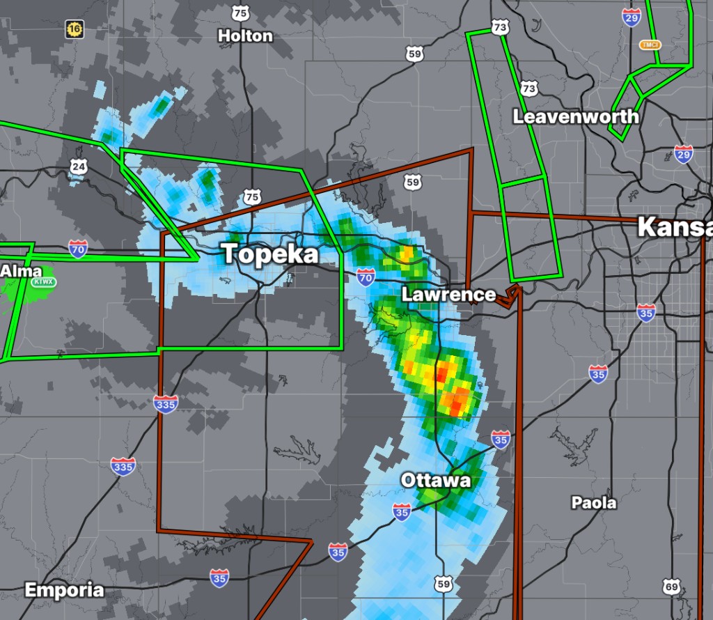
NEXRAD updates hit the map as soon as they leave the NWS radar sites. Watch storms evolve in near real time with scans that arrive the moment they're available.
Product dropdown → Radar
Custom Alert Colors
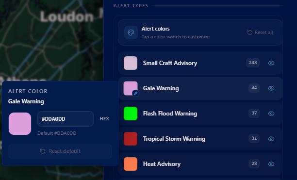
Make every watch and warning yours. Tap any alert swatch to set a custom hex color, or reset to the NWS default whenever you want a clean slate.
Alerts → Alert Types → tap a color swatch
Live Lightning Strikes Interval
Fine-tune how often live lightning strikes refresh on the map so you can balance freshness with performance during busy storm nights.
Map Layers → Lightning
Better MRMS — More Coming Soon
MRMS layers are smoother, clearer, and more reliable. A wider lineup of MRMS products is on the way — stay tuned.
Product dropdown → MRMS
PRO
Lifetime Pro founding offer and monthly trial options.
WX Rundown Pro — Lifetime Access $49
Pro
Unlock advanced radar, exclusive map layers, forecast tools, and more. Prefer monthly? Start with a 7-day free trial. Or for a limited time, founding members can grab Lifetime Pro for a one-time $49 — pay once, keep access.
Say hello to Skye, the newest member of the WX Rundown team! Skye keeps watch around the clock, delivering automated weather coverage so you never miss what's happening. Check out the all-new Skye page to see what she can do.
Open the menu → Skye
UPDATE
Go Live during WX Rundown streams from your location.
Go Live with WXRundown
Become part of the broadcast. Stream live from your location during severe weather and show us — and everyone watching — exactly what's unfolding where you are. Your view could go straight to air. Available only during live WXRundown weather streams.
Open the radar tools → Go Live
NEW
Advanced NEXRAD products, satellite, and tropical tracking.
Advanced Radar Products — Free!
We've expanded our NEXRAD lineup with professional-grade products at no cost. Analyze storm structure, rotation, and rainfall totals like never before.
Storm Relative Velocity — spot rotation and mesocyclones
Plus Correlation Coefficient, Differential Reflectivity, and more
Open the product dropdown → select Radar → pick your product
New Satellite Imagery
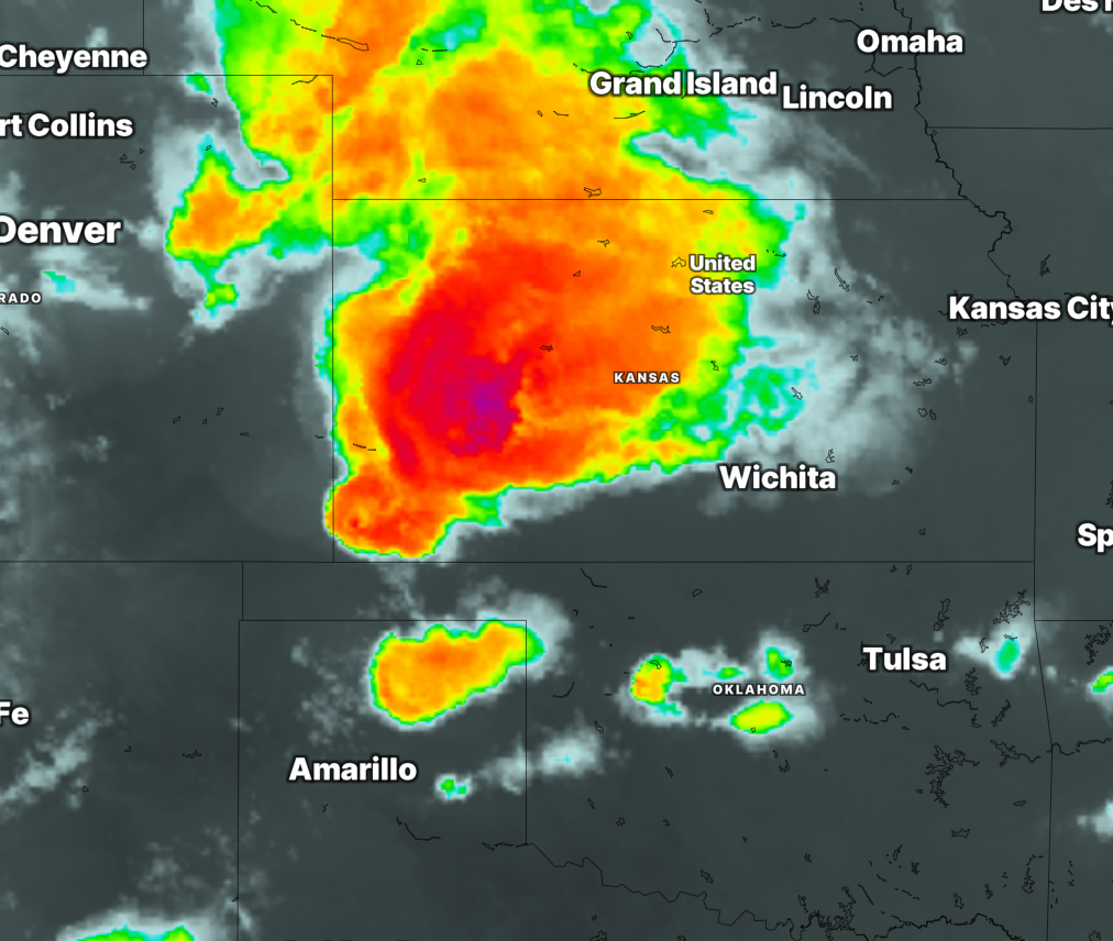
Fresh GOES satellite products with sharper detail and more band options. Animate recent scans to watch cloud tops, moisture, and storm development unfold from space.
Select Satellite from the product dropdown
Tropical Weather Tracking
Hurricane season is here — track active tropical cyclones, forecast tracks, and cone of uncertainty directly on the map. Stay ahead of developing systems in the Atlantic and Pacific.
Select Tropical from the product dropdown
UPDATE
Faster NEXRAD plus HRRR and MRMS layers.
Lightning-fast NEXRAD radar scans
Product dropdown → Radar
HRRR model data & MRMS radar layers
Product dropdown → HRRR or MRMS
UPDATE
Wildfires and earthquakes on the map.
Wildfires layer — active fires & prescribed burns
Map Layers → Wildfires
Earthquakes layer — USGS M2.5+ events
Map Layers → Earthquakes
UPDATE
Compare radar products side-by-side.
Dual Panel radar view — compare two products side-by-side